Basic Handhelds |
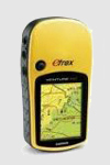
| E-TREX H |
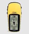 |
Perfect for outdoor enthusiasts on a budget, eTrex H comes with a high-sensitivity GPS receiver that locks onto satellite signals quickly and maintains accuracy — even in the toughest conditions. And just like the popular eTrex, this little yellow wonder combines an intuitive interface and a rugged exterior into a lightweight handheld that fits in the palm of your hand. |
| |
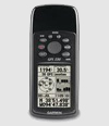
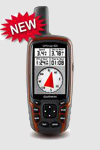
| GPS 72 |
 |
The mariner-friendly GPS 72 is WAAS-enabled for accuracy to within 9.84 ft (3 m) and features a large screen and easy-to-use buttons.GPS 72 floats in water, and its IPX7 waterproof to withstand the accidental dunk or splash in the lake. If you're into boating, hunting or fishing, you can use the 72's built-in celestial data, which includes tide information, sunrise/sunset times and a hunting and fishing calendar. |
| |
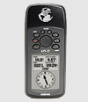
| GPS 72H |
 |
The GPS 72H is a low-cost solution for land or marine navigation designed to provide precise GPS positioning using correction data obtained from the Wide Area Augmentation System (WAAS). Find your way effortlessly with its high-sensitivity GPS receiver. GPS 72H acquires satellite signals quickly and tracks your location in challenging conditions, such as heavy tree cover or deep canyons. This rugged, waterproof, unsinkable GPS receiver offers a large, 4-level grayscale screen and a dedicated GOTO button. |
| |
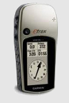
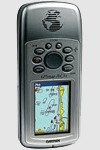
| GPS 60 |
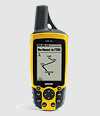 |
Backwoods, boundary waters, blue highways — the GPS 60 is your trusted guide to the great outdoors. The GPS 60 and its counterpart, the GPSMAP 60, are packed with several of the features found in the 60-series colour navigators, but sport an affordable, high-resolution monochrome display for outdoor enthusiasts on a budget. |
|
Mapping Handhelds |
| E-TREX VENTURE HC |
 |
The Garmin eTrex Venture HC is an essential GPS device for any outdoor excursion. It features a high-sensitivity GPS receiver for peak performance in any environment and includes 24 megabytes (MB) of internal memory, a detailed basemap and crisp color screen. |
| |
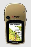
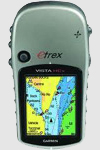
| E-TREX VISTA H |
 |
Ideal for serious hikers and climbers, the rugged Garmin eTrex Vista H GPS features a high-sensitivity receiver, detailed basemap, barometric altimeter, electronic compass and 24 megabytes (MB) of internal memory for extra data storage. |
| |
| E-TREX SUMMIT HC |
 |
A staple among outdoor enthusiasts, the Garmin eTrex Summit HC features a high-sensitivity GPS receiver for peak performance in any environment and includes 24 megabytes (MB) of internal memory, a detailed basemap, crisp color screen, barometric altimeter and electronic compass. |
| |
| E-TREX VISTA HCX |
 |
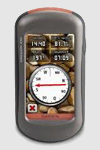
Deep foliage, nor canyons faze this rugged eTrex Vista HCx GPS unit! Its high-sensitivity receiver holds a GPS signal in the toughest environments. Similar to the eTrex Vista Cx, this handheld navigator also has a bright color screen, barometric altimeter, electronic compass, microSD™ card slot and automatic routing for wherever adventure takes you. Deep foliage, nor canyons faze the rugged eTrex Vista HCx. Its high-sensitivity receiver holds a GPS signal in the toughest environments. Similar to the Vista Cx, this handheld navigator also has a bright color screen, barometric altimeter, electronic compass, microSD™ card slot and automatic routing for wherever adventure takes you. |
| |
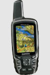
| GPSMAP 60CSX |
 |
The GPSMAP 60CSx is a refreshing upgrade of the GPSMAP 60CS, with two important differences. It uses a new SiRFstarIII high-sensitivity GPS receiver, which gives you GPS coverage even under dense foliage and in deep canyons.This unit features a removable microSD card for detailed mapping memory and a waterproof, rugged housing. The microSD card slot is located inside the waterproof battery compartment. Users can load map data and transfer routes and waypoints through the unit’s fast USB connection. |
| |
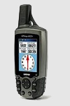
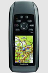
| GPSMAP 76CSX |
 |
The GPSMAP 76CSx is an upgrade of the GPSMAP 76CS, one of Garmin's most popular models for outdoor and marine use. This unit features a removable microSD card for detailed mapping memory and a waterproof, rugged housing. The microSD card slot is located inside the waterproof battery compartment. Users can load map data and transfer routes and waypoints through the unit's fast USB connection. |
| |
| GPSMAP 62 |
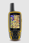 |
The newly designed GPSMAP 62 handheld navigator features a 2.6” sunlight-readable 65K color screen that supports BirdsEye™ Satellite imagery (subscription required) and Custom Maps. Rugged and waterproof, GPSMAP 62 features a quad helix antenna for unparalleled reception and sleek new design. |
| |
| GPSMAP 62S |
 |
The newly designed GPSMAP 62s handheld navigator features a 3-axis tilt-compensated compass, a barometric altimeter and supports Custom Maps, BirdsEye™ Satellite imagery (subscription required) and photo navigation. Rugged and waterproof, GPSMAP 62s employs a quad helix antenna for unparalleled reception, has a high-speed USB connection, a sleek new design and connects wirelessly to compatible Garmin handhelds. |
| |
| GPSMAP 62ST |
 |
The newly designed GPSMAP 62st handheld navigator features a 3-axis tilt-compensated compass, a barometric altimeter, preloaded 100K topo maps and supports Custom Maps, BirdsEye™ Satellite imagery (subscription required) and photo navigation. Rugged and waterproof, GPSMAP 62st employs a quad helix antenna for unparalleled reception, has a high-speed USB connection, a sleek new design and connects wirelessly to compatible Garmin handhelds. |
| |
| GPSMAP 78 |
 |
Garmin is pleased to announce the next generation in marine handhelds: the GPSMAP 78 series. Incorporating a sleek, new design and must-have features, these rugged units are a great fit in Garmin's best-selling lineup of color marine handhelds and they float! With its high-sensitivity, WAAS-enabled GPS receiver and HotFix™ satellite prediction, GPSMAP 78 locates your position quickly and precisely and maintains its GPS location even in heavy cover and deep canyons. |
| |
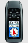
| GPSMAP 78S |
 |
For boaters and watersports enthusiasts who want to run with the best, the rugged GPSMAP 78s features a 3-axis compass, barometric altimeter, crisp color mapping, high-sensitivity receiver, new molded rubber side grips, plus a microSD™ card slot for loading additional maps. And it floats! GPSMAP 78s has a built-in 3-axis tilt-compensated electronic compass, which shows your heading even when you’re standing still, without holding it level. Its barometric altimeter tracks changes in pressure to pinpoint your precise altitude, and you can even use it to plot barometric pressure over time, which can help you keep an eye on changing weather conditions. |
| |
| GPSMAP 78SC |
 |
For boaters and watersports enthusiasts who want to run with the best, the rugged GPSMAP 78sc includes preloaded detailed world base map and features a 3-axis compass, barometric altimeter, crisp color mapping, high-sensitivity receiver, new molded rubber side grips, plus a microSD™ card slot for loading additional maps. And it floats! The 78sc model includes the sensors, offer wireless route and waypoint sharing with other compatible units. |
| |
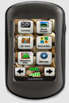
| OREGON 450 |
 |
Oregon 450 leads the way with a tough, 3-inch diagonal, sunlight-readable, color, touchscreen display that offers crystal clear enhanced colors and high-resolution images. Its easy-to-use interface means you’ll spend more time enjoying the outdoors and less time searching for information. With user-selectable dashboards, you can customize the appearance of your display. Both durable and waterproof, Oregon 450 is built to withstand the elements. Bumps, dust, dirt, humidity and water are no match for this rugged navigator. |
| |
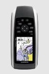
| OREGON 550 |
 |
The handheld GPS navigator with the photographic memory — the Garmin Oregon 550 combines rugged outdoor touchscreen navigation with a 3.2 megapixel digital camera along with a built-in basemap with shaded relief, a high-sensitivity GPS, barometric altimeter, 3-axis electronic compass and microSD card slot. The result? A multipurpose device that will make your biggest adventures even more memorable. |
| |
| DAKOTA 10 |
 |
Outdoor navigation meets touchscreen simplicity in the new Garmin Dakota 10. This rugged, palm-sized GPS navigator boasts touchscreen navigation, high-sensitivity GPS with HotFix™ satellite prediction, and a worldwide basemap in one affordable, power-packed punch. Also New! Dakota 20with barometric altimeter, 3-axis electronic compass, microSD slot!. |
| |
| DAKOTA 20 |
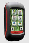 |
Garmin Dakota 20 makes outdoor navigation effortless with a tough, sunlight-readable, 2.6 inch colour touchscreen display. The interface is easy to use, so you’ll spend more time enjoying the outdoors and less time searching for information. Both durable and waterproof, Garmin's Dakota 20 is built to withstand the elements: bumps, dust, dirt and water are no match for this rugged navigator. |
| |
| RINO 130 |
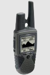 |
The Rino 130 has a built-in electronic compass, barometric sensor, weather receiver for seven NOAA weather channels, and 24 MBs of internal memory. This handheld radio has a built-in electronic compass to give a heading while the user is standing still, and a barometric altimeter to provide extremely accurate elevation and pressure information, which will assist users in identifying weather data. |
| |
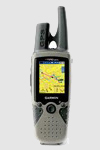
| RINO 520HCX |
 |
Know exactly where you are at all times with Rino 520HCx and the precision of high-sensitivity GPS. This waterproof FRS/GMRS radio plus GPS navigator sports 5 watts of transmit power, a microSD card slot and brilliant color display along with a high-sensitivity GPS receiver — so you’ll never be lost again. |
| |
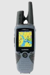
| RINO 530HCX |
 |
Know exactly where you are at all times with Rino 530HCx and the precision of high-sensitivity GPS. This waterproof FRS/GMRS radio plus GPS navigator adds a barometric altimeter, electronic compass and NOAA weather radio in addition to the popular features of the Rino 520HCx — 5 watts of transmit power, a microSD card slot, brilliant color display and a high-sensitivity GPS receiver. |
|